Omine-Okugake Pilgrimage Route

The Omine-Okugake pilgrimage hike from Yoshino to Hongu, a 5 day 65 miles hike through the mountains of Yoshino Kumono National Park in May 2025. Hampered by persistent rain.
The Omine Okugakemichi is the most rugged, remote, and challenging route of the Kumano Kodo pilgrimage trails. The Omine-Okugake has an over 1,300 year history of use by the Shugendo monks who travel to route praying at the 75 sacred sites (Nabiki).
This hike starts at the small mountain town of Yoshino in Nara. The lower town along the Yoshino River is mainly supported by the lumber industry which has been planting and logging for 500 years.
Bus Stop Tabacco
Lumber Yard Persimmon leaf sushi from local Hirasou Yoshino Honten 平宗 吉野本店
The upper town is much more commercial and features hotels, shrines, the famous cherry trees and the sacred Yoshino Mountain. Today the cherry trees number over 30,000 and are maintained and replanted. Yoshino has been known for it's cherry trees since the 10th century. After an early rise at Guest House Boschetto ゲストハウス 鍼灸院 {ボスケット), I started heading up the mountain by foot, passing the closed gondola station and the many silent shrines and shops along the way before hitting the actual start of the trail.
Sembonguchi Ropeway Station Kuro-mon Gate Gaurd Hut Statue of En no Gyōja beside Yoshino Mikumari Shrine Hossin-Mon Copper Torii Gate Akai Fudo Myoo
Once on the trail proper, you travel through the Hinoki Cypress and Yoshino Cedar groves passing small shrines along the way.
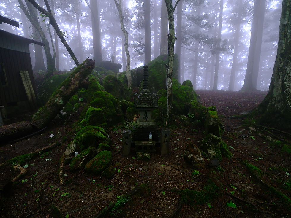

The Gomankan Women's Boundary Gate (女人結界門, Nyonin Kekkaimon) marks the entry to Mount Omine and the Ominesanji Temple grounds (大峯山寺). Passing through the somewhat controversial gates signifies leaving the secular world and entering the sacred zone for spiritual training. Mt. Omine has been a male only refuge for ascetic mountain training by Shugendo practitioners for 1,300 years . Shugendo combines Shinto, Buddhism, Taoism and Mountain worship in varying degrees.

The rain has started and the Tea House (洞辻茶屋) made a welcome respite for the day. The Tea House is at a somewhat busy crossroad and close to the Ominesanji Temple grounds (大峯山寺) so was able to witness Shugendo monks passing through. The Tea House is quite primative with small snacks (thank you for the hard boiled egg and hot tea) and drinks if it happens to be staffed.
Dorotsuji Chaya (洞辻茶屋) Teahouse on Mount Omine (Sanjogadake) Rigen Daishi (Shōbō) Bronze Statue behind Dorotsuji Chaya (洞辻茶屋) Teahouse Inside Dorotsuji Chaya (洞辻茶屋) Teahouse on Mount Omine (Sanjogadake)
End of day 1: 10.7 Miles, 3939 ft elevation gain. Yoshino (吉野町) to Dorotsuji Chaya Teahouse(洞 辻茶屋).

Omine-Okugake Day 2
The morning brings more steady rain and a chill in the air. With some reluctance I leave the shelter of the Tea House and start traveling.

Setting a good pace the climb to Nishinonozoki 西の覗 resulted in a cloud filled valley obscuring the long drop to the valley below. The hike through the Ominesan-ji (大峯山寺) temple complex is quiet with the early hour and steady rain. Eventually passing through the Amida Forest women's boundary gate (女人結界門, Nyonin Kekkai-mon) heading for Mt Daifugen (大普賢岳).
Ridge in the Rain Nyonin Kekkaimon (Women's Boundary Gate) at Amida-ga-mori Dogwood Filled Ridge Wild Rhododendron False Hellebore - Veratrum stamineum (Kobai-kei-so) Trail to Hichiyodake (七曜岳)
The Ridgeline here through Mt Daifugen (大普賢岳) and Gyojagaeridake
(行者還岳) features mesmerizing monospecific stands of Dogwood, Wild Rhododendron, Japanese False Hellebore, and Sasa.
After a challenging day on this demanding section negotiating and chains and ladders in the rain, Misen Lodge (弥山小屋) was a more than welcome sight. Originally the plan was to tent camp at Misen Lodge but with darkness coming soon and soaked to the bone I elected to stay in the lodge. A Dry room and warm place were more than welcome. Thanks to staff for accommodating me with the late arrival.
End of Day 2: 11.5 Miles 3768 ft elevation gain. Dorotsuji Chaya (洞辻茶屋) Teahouse to Misen Lodge (弥山小屋)

Omine-Okugake Day 3
Misen Lodge (弥山小屋) Misen Shrine 弥山神社
Waking to the sun brings a welcome start of the day. Today is probably not only the most challenging and remote section of the Omine-Okugame, but also the most beautiful with a mostly open ridge for wondereful views.

Ladder on the Trail to Gokonomine (五鈷嶺) A Day Break at Yōshi-juku Emergency Shelter (楊子宿避難小屋)
Many chains covering the ups and downs of this section of the Omine-Okugake. The Mountains seem taller with more exposure and rock along the ridgeline. It's slow progress on this section, with steep and overgrown sections still wet from the previous days rain.


Ascending the ridge to Mt Shakka (釈迦ヶ岳) I get my first sighting of a Japanese black bear in the wild. The Bear runs away quickly and I can continue the steep climb to the top of Mt Shakka (釈迦ヶ岳). The Summit offers the Shaka Nyorai(釈迦 如来) Statue which was carried up the mountain in in pieces by Matsutaro Onishi in 1924 who took many trips to get it up the mountain. This Summit is a great place for a breather and a snack while taking in the views.


Leaving the Summit of Mt Shakka (釈迦ヶ岳) behind, the wide ridge ahead offers a respite from the ascent earlier in the day. This sparsely wooded area is filled with sasa and false hellebore. Many deer roam this area.

Water Source Trail South of Mt Shakka (釈迦ヶ岳) Teeming With Deer


Not much further down the ridge is Jinsen no shuku Hut (深仙の宿). A rustic hut with a Kanjodo (潅頂堂) close by and a spring flowing from the rocks. Sitting on a saddle of the ridge if offers great views. The hut is very rustic but dry. A good thing since the clouds darkened and rain started falling soon after dinner.
End of Day 3: 8.13 Miles 1,766 Elevation Gain. Misen Lodge (弥山小屋) to Jinsen no shuku Hut (深 仙の宿)

Omine-Okugake Day 4
Another tough morning. The rain has not stopped all night and continues heavy today. Gave a thought of simply staying at the hut today and wait the rain out but with no weather report I head out hoping for the best. The trails are slick and have no choice but to embrace the wetness. Now on the southern section the the Omine-Okugake, the scenery has changed to slightly less brutal peaks. Hillsides filled with Sasa cover the mountainsides. The trees also differ with an abundance of Japanese Beech trees, Evergreen Oaks and Japanese Cedars. Rhododendrons and Japanese Andromeda fill in the understory. One particular Sasa filled hillside was teeming with Japanese Toads enjoying the rain and had to be careful not to step on them. There were signs of wild boar but it seems the rain had put most animals into hiding.
Japanese Toad Nippon Telegraph and Telephone Station on Gyōsen-dake (行仙岳)
With short breaks from the rain at Jikyo-shuku Mountain Hut (持経宿山小屋) and Heiji no Yado Hut (平治ノ宿) the day is a bit of a blur and had to force myself to keep going after the relative comfort of the Huts. Reaching Mt. Gyosen (行仙岳) I was much surprised with its NTT (Nippon Telephone and Telegraph) building and towers. As darkness was getting closer Gyosenjuku mountain hut (行仙宿山小屋) was a welcome sight. Inside the Hut I was a bit surprised to see the first person since leaving Misen Hut 2 Days before. Not only was this a dry place to sleep but the other hiker had a fire going in the stove and hot water ready to go. It did not take long to strip off layers of wet cloths and hang them to dry. Once dry and comfortable, I enjoyed some food and shared some miso soup with my fellow guest. I am still grateful he knew how to hut operated. Lights, a fire, water and a stove were the highlight. Enjoyed a conversation in my limited Japanese and even got an updated weather report calling for clear skies the next day.

End of Day 4: 11.7 Miles 3274 Elevation Gain. Jinsen no shuku Hut (深 仙の宿) to Gyosenjuku mountain hut (行仙宿山小屋)

Omine-Okugake Day 5

Blue Sky and Sun Today. The trail still has it challenges but the feeling of remoteness has faded. This section of the Omine-Okugake sometimes shares itself with powerlines and old mountain roads.
Mt. Kasasute 笠捨山 Shrine and Summit Clubmoss Loving the Recent Rain Fancy new trail markers. Only 27.6km to go. Trail markers High-Voltage power lines running through the Omine-Okugake Trail Conditions. Steeper than it looks
The trail today goes through Mt. Tamaki 玉置山 and the Tamaki Shrine 玉置神社 complex. As It gets closer the trail follows along the access road. The line of cars heading up to the shrine complex seem blaringly loud after the solitude of the mountains. Once into the temple grounds the crowds are a bit anxiety inducing.

The Tamaki Shrine 玉置神社 complex is a beautiful area with multiple shrines and famous ancient Cedar Trees. The Tamaki Shrine 玉置神社 itself was founded in 37 B.C. and claims to be the oldest shrine in Japan. For a remote shrine i am amazed at its popularity.
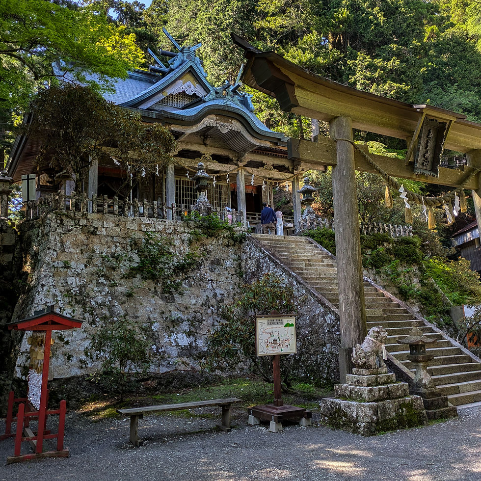
Once past the shrine complex the serenity returns to the trail. The climb up Mount Omori (大森山) is a maintained forest of Cedars. The Weather is good and the tent a pitched on the ridge among the trees for the night.
Kamihira Chikara Monument near Tamaki Shrine Tamakijinjanoosugi 大杉 . One of the Ancient Cedars on Mt. Tamaki Camp in the Cedars
End of Day 5: 14.9 Miles 4,434 Elevation Gain

Omine-Okugake Day 6
Fudo Myoo Shrine on Mt. Godaison First Sight of the Finish. Kumano River and Hongu Rokudo-no-Tsuji Shrine 六道ノ辻
The last ridge and the last day on the Omine-Okugake. It is a day of mixed emotions as more small shrines are passed and my destination can be seen in the distance at times along the forested ridge. With the lower elevation and forest has turned more robust and thicker.
Trail Official Trail Markers The Unimpressive summit of Daigoku-dake (大黒岳) So close to the End. Hongu From the Final Ridge. Osaihara Observatory (大斎原展望地) Official Signage. Omine-Okugake Bizaki Bridge and Kumano River
Once at Osaihara Observatory (大斎原展望地) the trail turns to road walking with connector trails. Nanakoshimine Forest Park (七越峯森林公園) offers a last water refill before the last stretch of ridge before the Kumano River.


Choosing not to ford the waters of the Kumano River, I pass over the Bizaki Bridge (備崎橋) and into the Oyunohara Sanctuary (大斎原) and through the Kumano Hongu Taisha (熊野本宮大社). The largest torii gate in Japan with rice paddies on one side and the sanctuary on the other is a rather impressive site. Continuing on to the Kumano Hongu Taisha 熊野本宮大社 shrine the trepidation is real as this beautiful shrine is a mass of tourists and activity. A far cry from the solitude and meditative exploration of the Omine-Okugake.

After a bit of temple exploration and a Katsu Curry at きっちん in Hongu it is time to head for Yunomine Onsen.
End of Day 6: 15.2 Miles 1,881 ft Elevation Gain. Ridge past Tamaki Shrine 玉置神社 to Kumano Hongu Taisha熊野本宮大社


Time for a much needed break at Yunomine Onsen. Just a short hike over the hill from the busy Hongu, Yunomine offers a a quaint setting with an 1,800 year old hot spring. The budget J-Hoppers Kumano Yunomine (ジェイホッパーズ熊野湯峰ゲストハウス) offers a Japanese style room with a futon that felt divine after the long trek. The private onsen melted away the soreness from the previous day journey. A budget meal at Yunomine Onsen Dining Hall
(湯の峰温泉 お食事処) filled the void with no flair Japanese classics. The Obaason running the place seemed standoffish at first but as I continued to order her attitude changed. Whether she was just amazed at the sheer amount of food I ate or she realized I wasn't one of the uncouth tourists I will never know. What better to end the day than a few beers, sake and gyoza at You-got-it Bar (湯垢離バー湯垢離バー).
Room at J-Hoppers Kumano Yunomine 熊野湯峰ゲストハウス One of 3 Private Onsen at J-Hoppers Kumano Yunomine Yunomine Gyoza Beer Sashimi
The next day is relaxed, heading back over to Hongu for lunch at Miyazushi (宮ずし) and the long bus ride out of the mountains to Tanabe (田辺市) on the coast. Although excited for for my time in town, part of me is already missing the mountains.

Yunomine onsen Yuzutsu 湯筒 Mineral Buildup from Hot Spring
Comments